
Advanced Carbon Monitoring
Smartphone-based GIS Applications
In 2016 Ithaka created the carbon subscription system where CO2-emitters can enter into long term contracts with private farmers in Nepal. The farmers guarantee the plantation and maintenance of forest gardens whereas private subscribers guarantee payment of a monthly fee for the carbon sequestered in the newly established forest garden. The system is based on a smartphone APP monitoring tree growth, tree use, and soil organic carbon for each single parcel of farmer owned land. Thanks to this APP, the CO2-subscribers can follow via the internet the growth and carbon sequestration of each tree for which they paid carbon credits. Ithaka’s open-access GIS-APP approach simplifies the monitoring process and may build a bond of trust and personal connection between smallholder farmers and carbon emitting citizens.
While reducing the greenhouse gas emissions by at least 90% in the next 20 to 30 years is a primordial condition to limit climate change, only when these efforts are coupled with massive sequestration of carbon in the biosphere, could climate change really begin to be stabelized. Currently the only feasible and multifunctional strategy without negative side-effects (like geo-engineering approaches) is Carbon Farming. Carbon Farming uses the photosynthesis of plants in forest- and agroecosystems to actively extracts CO₂ from the atmosphere and to sequester the bio-accumulated carbon in a stable form via carbonization and storage of the resulting biochar (i.e. as soil organic carbon, biochar, building material, etc.). Although some largescale reforestation projects are on the way, to gain global significance, widescale adoption by smallholder farmers must be included.
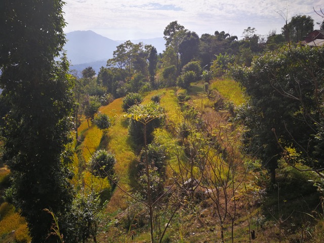
Figure 1: Typical forest garden with mixed cropping after three years in Ratanpur.
While industrial farming captures most of the policy and media attention, more than 1.5 billion smallholder farmers feed more than 60% of the global population. When smallholder farmers adopt increasingly Carbon Farming methods instead of high input monocultural cropping, the 1.5 billion smallholder formers would advance to become a key solution for climate mitigation. One of the main obstacles to smallholder inclusion into carbon trading schemes are monitoring costs. But thanks to the new information and data technology, low cost farm scale monitoring of carbon sequestration becomes economically feasible
Since 2018 Ithaka is working on the development and field testing of a smartphone-based GIS (Geo Information System) application. In a three steps approach, the application collects all information needed to create a solid assessment of the carbon stock and carbon dynamics in any given forest garden land unit.
1. Area Data:
The data collector walks along the borders of the field taking GPS coordinates using the mobile app. The land coordinates are sent via the internet to the Ithaka servers. Based on a dynamic database, the computer automatically creates a map and calculates the plot area. Photographs of the land and responsible farmers as well as data about the farmers, owners, county, district etc. are further recorded.
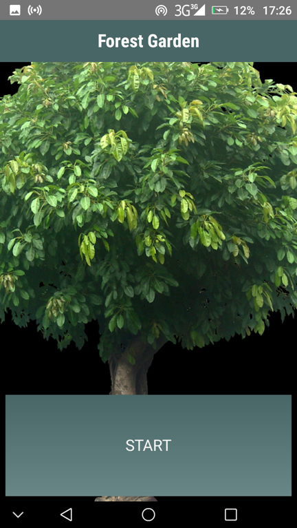
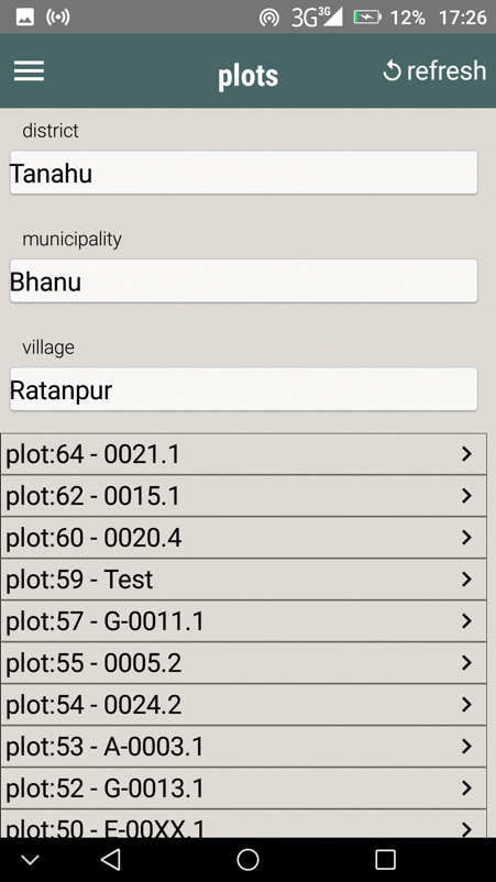
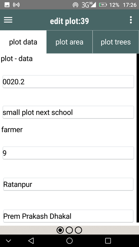
Figure 2: Screenshots of the forest garden mobile app.
2. Soil Carbon Data:
Parameters regarding soil organic matter (30cm) and bulk-density, prior obtained through simple loss-on-ignition analysis or from reference databases, are attached to the area data.
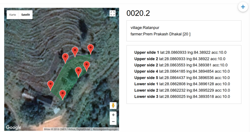
Figure 3: Example of a forest garden plot mapped with Ithaka's GIS App.
3. Volumetric Tree Data:
In the last major step, the data collector records the tree components of the system. He/she obtains the GPS coordinates of each individual tree, records data regarding height, diameter, species (specific wood density), and takes a photo of the tree. This data set will be sent to the server’s dynamic database and fed into allometric formulas.
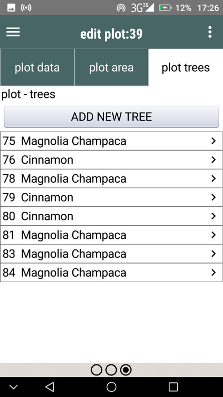
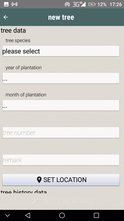
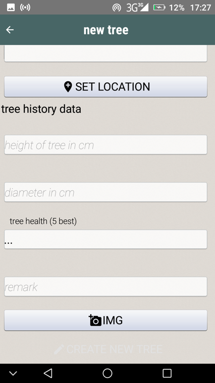
Figure 4: Screenshot of forest garden app showing how to map and register trees.
Having access to those datasets enables the automatic calculation of the total carbon currently sequestered per farmer. As an additional feature, the program not only registers personal data and pictures of the farmer, but also of the CO2-subscriber to create a personal link between farmer and emitter.
After some further tests and development, the mobile app can be downloaded for free and the software code will be made available as open source for further community development. The program is set up in a way to foster high usability and to be self-explanatory. This method eliminates the need to have highly trained and expensive experts to conduct monitoring activities. The task can be accomplished by designated farmers or students.
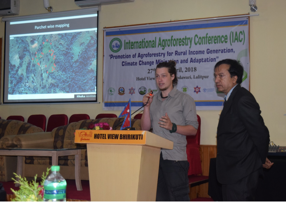
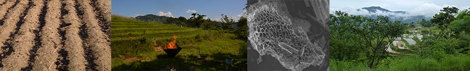
Figure 5: Presentation of the GIS-APP Approach at the International Agroforestry Conference, 2018